OkMap

OkMap is a powerful software for mapping, analyzing, and visualizing GPS data. It’s especially useful for professionals who need to plan, track, and manage their journeys or outdoor activities with advanced features.
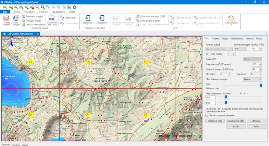
 

OkMap
OkMap

Key Features of OkMap:

  • GPS Data Integration: Easily transfer and visualize GPS data by connecting your GPS device to your computer. You can view the data directly on the map in real-time and analyze various statistics for research or planning purposes.
  • Real-Time Mapping: Once your GPS device is connected, you can see your route live on the map as you drive or travel. OkMap displays all the paths you’ve taken in real-time, giving you precise and up-to-date information about your journey.
  • Support for Various Data Formats: OkMap can accept vector data in multiple formats and DEM (Digital Elevation Model) data for terrain elevation information. It supports different types of map files, including formats for GPS devices.
  • GPS Navigation & Coordinate Management: The software allows you to set up automated navigation, track geographic coordinates, and adjust elevation settings automatically for different routes.
  • Google Maps & Google Earth Integration: You can connect OkMap to Google Maps and Google Earth, allowing you to view your paths in 3D and explore your route from different perspectives. This feature is especially useful for users who want a more immersive experience.
  • Send/Receive Data Over the Internet: With OkMap, you can send and receive location data via the internet, making it easy to share routes, points of interest, and other data with others.
  • Route Organization: OkMap enables you to organize your routes with waypoints and stations, extending compatibility to various GPS devices, so you can easily plan and navigate your journey.

Use Cases for OkMap:

  • Adventure and Travel Planning: Ideal for outdoor adventurers and travelers who need to map out their routes, track their movements, and share or receive location data during the trip.
  • Field Work for Research: Beneficial for geographers, surveyors, and researchers who need to collect and analyze data related to land topography and terrain elevation.
  • Real-Time GPS Tracking: Perfect for those who need real-time updates on their position while navigating, especially useful for long journeys or off-road navigation.

OkMap stands out with its robust integration of GPS devices, map visualization capabilities, and seamless interaction with services like Google Earth, making it a must-have tool for anyone working with detailed geographic data.