ExpertGPS

ExpertGPS is a powerful application designed to assist with planning outdoor adventures and managing GPS data. It helps users mark destinations on USGS topographic maps, calculate distances, elevations, and slopes, and seamlessly transfer data between GPS devices and various file formats. Whether you’re a geologist, adventurer, or professional needing GPS data management, ExpertGPS offers a comprehensive set of tools to simplify your tasks.
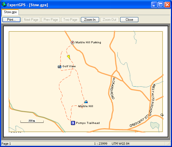
 

ExpertGPS
ExpertGPS

Key Features of ExpertGPS:

  • Topographic Mapping and Planning: Easily mark destinations on USGS topographic maps and plan your route with high precision.
  • GPS Device Integration: Connects with popular GPS receivers like Garmin, Magellan, and Lawrence. You can transfer data from your GPS device to your computer and vice versa.
  • Data Export and Import: Export data to various formats, including GPX, KML, KMZ, Excel CSV, TXT, and AutoCAD DXF within seconds. This compatibility ensures the smooth transfer of data to other GIS, CAD, or mapping software.
  • Offline Maps: Download and store topographic maps for offline use, allowing you to continue planning and navigating without an internet connection.
  • Geographic Data Labeling: Add geographic labels to images or map environments, helping to accurately document the locations you discover.
  • Accurate Measurements: Calculate distances, areas, elevations, and slopes with ease, which is especially useful for land surveyors and geologists.
  • Error-Free Data Transfer: Unlike other software, ExpertGPS ensures accurate data transfer without format conversion errors, allowing seamless integration with GIS or CAD applications.
  • Add New Routes or Trails: If you discover a new route or trail, you can easily add it to your map, ensuring you can navigate it offline later.


ExpertGPS

ExpertGPS is particularly advantageous for those who need accurate, error-free GPS data management and mapping, especially when dealing with large datasets or remote areas where internet access may be limited. The software’s ability to handle various file formats (such as KML, GPX, DXF, SHP, and more) and ensure compatibility with various GPS devices makes it a versatile tool for many users.