OpenCities Map

OpenCities Map Advanced extends the capabilities of MicroStation to provide a similar user experience to that of Computer-Aided Geographic Mapping (CAD), enabling the creation of geographic maps based on feature-based modeling and supporting integrated data stabilization.

It enhances productivity, efficiency, and data security by providing a multi-user editing environment where each function can be individually locked when connected to a spatial database.
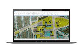
 

OpenCities Map
OpenCities Map


OpenCities Map Advanced is a comprehensive Geographic Information System (GIS) designed to meet the unique needs of organizations mapping, planning, designing, constructing, and commissioning global infrastructures.

Bentley OpenCities Map is a professional 2D and 3D mapping software. It provides you with the ability to analyze, design, share geographic information, and create maps in a powerful environment.

It allows you to collaborate confidently with GIS experts worldwide to create high-quality maps and integrate diverse 2D and 3D data.

Key Features of OpenCities Map Advanced:

  • Save time and avoid rework by creating precise geometry, editing, and mapping tools.
  • Use a powerful and flexible API to develop custom GIS applications.
  • Analyze data with tools like caching, thematic coverage maps, and 3D collision detection. Perform shadow analysis.
  • Create custom GIS software tailored to your needs. The software is highly flexible and comes with an extensive custom API, supporting languages such as C/C++, C#, .NET, and others. It includes extensive documentation and samples.
  • Enhance interoperability by combining data in Esri native format. Directly connect and negotiate with a geographic file database.
  • View and input data directly from Web Feature Services (WFS). Access updates and manage spatial data in Oracle Space, Microsoft SQL Server, and Esri Files.
  • Manage and edit unstructured data, geographic layouts, architectural and engineering maps, etc. Save and manage 3D city data, including 3D modeling and data path simulations.
  • A complete GIS system for desktop mapping and 2D and 3D visualization.
  • Manage and analyze geographic data efficiently.
  • Geospatial mapping based on code tools.
  • Manage and retrieve data from separate sources, regardless of dataset size.